|
Stokes Croft |
|
| Early History Stokes Croft is one of the oldest routes in to Bristol. It will have originated as a track between fields certainly by about 1000 years ago if not earlier. By the twelfth century it was probably being regularly used by travellers coming to markets in Bristol, particularly St James's Fair.
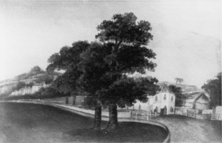
The following information comes from http://www.bristolinformation.co.uk/streets/ "Stokes Croft was originally known as Berewyke's Croft and took its later name from John Stoke, mayor in 1364, 1366 and 1379, who owned the land up until his death in 1382. This land is referred to in a deed of 1579 as a field containing one little lodge and a garden. Through the grounds ran a footpath and in 1618 the city paviour received 6d for mending holes in the stile." Seventeenth & Eighteenth Century Probably the earliest depiction of Stokes Croft is this image of Stokes Croft gate and toll house in 1742.
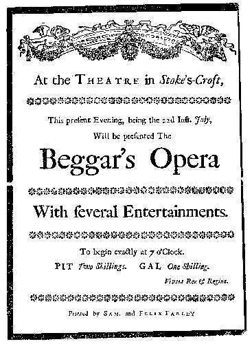
We don't know when the gate was established, but we know that in the early 1640s it formed part of the northern line of defences protecting Bristol during the English Civil War of 1642-1646. In 1643 it was described by the Royalist engineer, Sir Bernard de Gomme as "a strong port of timber barres". Listed in the Boundaries of the City as recorded in Barrett's History are the markers of 'a stone fixed in the corner of a ditch called the Upper Stoke's Croft' and 'a stone pitched on the south corner of the same ditch in Upper Stoke's Croft aforesaid'. Among the 18th century Quarter Session records is 'James Martin, James McCann and Edward Sainsbury ordered to be whipt from Newgate (near the present Galleries shopping centre) to Stokes Croft turnpike' (http://www.bristolinformation.co.uk/streets/). Just beyond this gate, in the first half of the 18th century, the Stokes Croft Theatre was in operation at the foot of Nine Tree Hill. Being just beyond the city boundary it was conveniently also beyond the city's stringent bylaws.
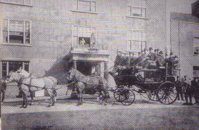
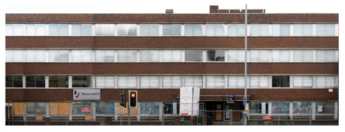
Later History More information about the later history, particularly the Victorian era can be found on the other THI pages. It was during the second half of the nineteenth century that Bristol more than doubled in size and many of the buildings in and around Stokes Croft date to this period. Houses, shops as well as factories were built in the area. The most prominent surviving industrial building on the street is T and J Perry Carriageworks. Stokes Croft even had schools and a circus. The next major change to the area came as an impact of the Second World War. Many of the buildings at the southern end of Stokes Croft nearer the city were badly damaged or destroyed during air raids in the early 1940s. The Baptist College building was probably the most northern Stokes Croft building to be a casualty of the war. This is now the site of the 1970s office building, Hamilton House.
|