By Pauline Harvey
This area, on which the Hillfields council estate was built was once part of the ancient forest of Kingswood, which provided game for the Saxon kings of England, and later, the Plantagenets. Kingswood Forest was the scene for the assassination of a Saxon King, Edmund, in 940. It’s said by some historians that Edmund met his end in a palace at Pucklechurch, others say it is more likely he was murdered in one of the hunting lodges in the vicinity.
From the late twelfth century, when King Richard was away from the country crusading, his brother John was virtual King, using Bristol Castle as a base to rule. During this time, perhaps after he became King officially, John built his lodge on an elevated point just above, and bordering on the present Hillfields Estate, within the King’s Woodland. It was near the current site of Cossham Hospital. Over time there were other lodges, but King John’s would have commanded the best view of the forest.
In 1227, Henry III, son of King John, deforested most of the area and kept Kingswood Chase – a small part of it. This was a district of ‘wood, scrub and wasteland’, the jurisdiction of which seems to have been subsequently in dispute for centuries. Elizabeth I further confused claims to ownership by granting the Manor of Barton – on which the Hillfields estate now lies – ‘away from the Crown’ without mentioning the parts of the Chase that lay within its bounds. The word ‘forest’ was apparently a legal term at the end of the sixteenth century, which perhaps explains some of the confusion from Elizabethan times onwards. By 1566, ‘’all manner of fewell’’ here was ‘’good and cheap’’, and in 1620, coal, extensively mined in the surrounding area, was in general use. Throughout the medieval period the forest was subject to clearance, and settlements were formed where the trees had grown. (Quotes from Brown, 1994)
An old map of Kingswood (1610), reproduced in 1839, and in 2014 on a website by Paul Johnson, shows the Hillfields area covered by woodland, lying within a small triangle between ‘Gosthill’s Gully’ (the Gossy) below Speedwell Playing Field and Whitefield Road – and Mangotsfield Ways. This ancient track roughly followed the present Ridgeway Road, which must have once continued along Goodneston Road and perhaps beyond to Staple Hill and Mangotsfield, before the railway was built, which now borders the estate below Marshfield Road. On the East side of the triangle was more wood – stretching roughly along what is now the west side of the Ring Road, from Warmley to Mangotsfield. This area was divided by a track running from Conham Hill to Staple Hill, roughly corresponding to Hanham Road, Spring Hill and Sweets Road. Lodge Causeway, which borders Hillfields on the southern west side is also represented on the map as a track.

Gradually this area was carved up, so that at the the beginning of the 17th century, the Berkeleys, Newtons, Players and Chesters were enjoying the Lord’s right to wood and coal, and in 1670 the Chase was divided into four main Liberties. This meant the land was claimed without authority. Crown control of the forest area was disputed by the landowners, who fought for their claims. By the eighteenth century the Chase, in which the present estate lies, consisted of 3,400 acres. Sometimes it was called a ‘Chase’; at others, a ‘forest’ – so that the royal presence and ownership became unclear. By the end of the seventeenth century almost all the deer were gone. However, the woods continued to provide cover for poaching into the eighteenth century and probably beyond. The Lodge eventually became home to the Duke of Beaufort’s steward, who watched over the coalmines below in what is now the Woodland Way area. Occasionally, deer can still be seen as you leave the built-up area of Kingswood on the Bath and Marshfield Roads.
Over the years the land was enclosed, as can be seen on a 1780 enclosure map. The hedge on the Forest Avenue side of Hillfields Recreation Ground is, I believe, one of these original enclosure hedges, blossoming with May now, at the time of writing. There remain other old hawthorn hedges around the estate, at the backs of houses.
In 1779, the enclosure act ended all common rights to much of the land. The Dukes of Beaufort, themselves descended from the same King John who had the hunting lodge built, sold the land on which it stood to Handel Cosham, a colliery owner, in 1875. The old lodge was completely decayed by 1615, and was rebuilt or extended several times before Cosham presumably tore it down to build his hospital close by. There is a photo on flickr.com, with an internet article by Paul Townsend on King John’s Lodge, of the last remaining structure, in 1905. It is turreted, and half covered in creeper. Apparently a centuries old tree was cut down in the hospital grounds, and a fragment of the old lodge could still be seen within living memory – possibly there are still remains in private gardens nearby.
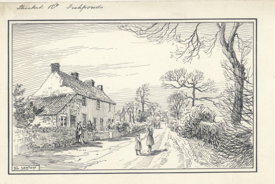
Hillfields was part of one of the last remaining large expanses of the Chase. A map by B. Donne, printed on the cover of Avon Past7 names the area as part of Lodge Heath – without roads or buildings, in 1769, although the earlier 1610 map shows another lodge just north of the present Woodland Way, where a path still runs from Cosham Hospital. There were another two lodges in the seventeenth century, according to Peter Brown – ‘one decayed and one a Berkeley alehouse’. The Earls of Berkeley also owned much of the adjoining land. Thicket Avenue, named after a thicket near where the Baptist Church now stands was apparently first formed by the Enclosure Commissioners in 1780, and was an isolated, lonely track. It was also known as Thicket Lane and there was a dewpond there.

In Soundwell a spring rose and joined another – this watercourse can still be seen at the back of Beechen Drive houses. Although at their higher end the streams have been covered, they still appear to flow in very wet weather, when part of the field becomes marshy, and water emerges from pipes below the Recreation Ground. Pools and a stream overflow the ditch at the lower end, from where it continues down garden paths into the drains. There are always frogs around this area. Once, according to old people interviewed by Hillfields historian Jane Baker in the early 1990s, the water was deep, clear and clean.
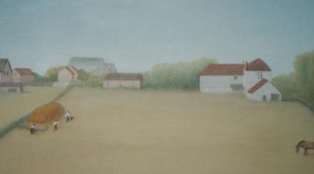
In the nineteenth century, Hillfields still sounds like a pleasant, rural environment, where the corncrake lived in the wildflower fields. The very old people – some in their nineties – in Jane Baker’s books could remember the remains of this. There were fields, orchards and market gardens in Marshfield Road, Bill Lypiatt recalled. Stanley Nicholls spoke of old trees behind Thicket Avenue, and blackthorn blossom – the remainder of which can still be seen behind the Baptist Church, in the Recreation Ground. Sometime before 1910, suffragettes burnt a haystack in Grindles Fields – part of Briar Way. Clear well water was still drawn in war-time from Acacia Road. Some oaks from the old forest remained, left in people’s gardens when the estate was built – possible descendants of these can be glimpsed at the backs of houses on the south eastern side of the estate. At Hillfields School, there is a 70-year-old oak, especially planted. I found a sapling growing naturally outside our front hedge, so saved it from the Council grass cutters and it now grows in our back garden. In the front gardens, wildflowers still grow on some lawns laid with turf from the original fields, and in many gardens around the estate grow apple trees, which I believe were first taken from the old orchards. According to a neighbour, some of these trees still grew in the latter half of the last century, by a lane which runs from Forest Avenue along the back of Beechen Drive, where an oak tree still grows today.


So although Hillfields may seem to some – as it did to me when we first moved here more than 20 years ago – a rather uninteresting place, it has layers of history. As recently as 1987 coal seams and shafts were revealed at the bottom of Beechen Drive, Briar Way and Hillfields Avenue, and old wells still exist. The displaced Belgians who first occupied the newly built houses of Beechen Drive after the ‘Great War’ in 1919 were forerunners to the different nationalities who occupy many of the houses on the estate today.
Acknowledgements:
Baker, J., (1989), ‘Hillfields The First Sixty Years A Local History Study’, Copies in Hillfields Library and in Bristol Archives, B Bond Warehouse, Smeaton Road, Bristol
Baker, J., (1993), ‘Nature Notes’, Hillfields Library
Baker, J., (2003), for Bristol and Avon Family History Society, Journal 114, [online], Available at: bafhs.org.uk/bafhs-parishes/other-bafhs-parishes/73-fishponds
Bartlett, J., Penny, J., (2001), Fishponds, its Boundaries, Churches and Chapels, Bristol, Fishponds Local History Society
Braine, A., (1969), ‘The History of Kingswood Forest’ In Staple Hill Library
Brown, P., (1994), ‘The Bristol and South Gloucestershire Coalfields’, in Staple Hill Library
‘Fishponds Stapleton and Frenchay’ [online], Available at: fishpondsbristol.wordpress.com/local-interest
Hattaway, M., (2009), (ed.), ‘Introduction’, As You Like It, U.K., Cambridge University Press, p.2
Johnson, P., (2017), ‘Introduction’, ‘Bristol Past’; Penny, J., ‘Fishponds and its History’, FLHS members [online], Available at: fishponds.org.uk/index.html
La Trobe – Bateman, E., (1997),‘Kingswood and Mangotsfield’, Avon Extensive Urban Survey Archaeological Assessment Report, [online], Available at: southglos.gov.uk/documents/pte070179.pdf
Lindegard, D.P., Grudgings, S., (2016), Killed In A Coalpit Lives of the Kingswood Colliers, Basingstoke, South Gloucestershire Mines Research Group
Moore, J.S., (1982 – 3), (ed.) Russell, J., Malcolmson, R.W., Avon Past 7,Bristol, Avon Archaeological Council and Avon Local History Association
Samuel, J., (2000), ‘Watching Brief Excavations At Moat Farm, Pucklechurch, South Gloucestershire, in Bristol & Avon Archaeology, Great Britain, Authors and Bristol and Avon Archaeological Society, pp. 12 – 13
Townsend, P., (2007), ‘Lodge Hill, Kingswood, South Gloucestershire’ [online], Available at: www.flickr.com>photos>brizzlebornand bred