This Bristol story begins before the Second World War, before homes in St Pauls were demolished in the name of slum clearance, before Broadmead shopping area was built in the 1950s, with all the top names in retail.
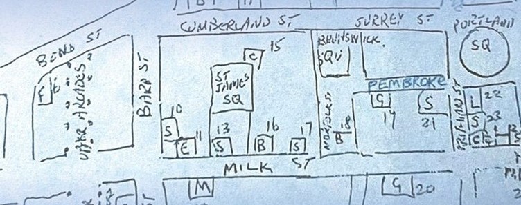
This story starts with a casual recollection of long gone streets and houses, mapping memories of a neighbourhood no longer there, of a lost Jewish community. The late Julius Burke, born 1923, many years later recalled the places he would visit on his tricycle, passing children barefoot on ‘Philly-i-fi Street’, popping into his father’s drapery on ‘busy, thriving’ Cumberland Street and the ‘great hullabaloo’ when goods were delivered, ‘plonking their horses and drays and carts outside the warehouse, baskets and cases from all over the world with traffic jams all held up’.
A grant from Historic England made it possible to explore Our Neighbourhood Heritage and we began with a gathering in St Pauls Library to discover together more about this pre-war Jewish quarter and the stories of those who had lived, worked and grown up there.
Visitors shared their connections with the area and each other and mapped the journeys and routes that had, over the years, brought them to this place and led them to participate in this project.
Read our PROJECT REPORT here.
“What I particularly valued was the way the work started from lived experience and community memory, rather than from a pre-set heritage narrative.
Beginning with Julius Burke’s map and stories created such a strong, human anchor for the project, and it felt like everything else grew very naturally from that.
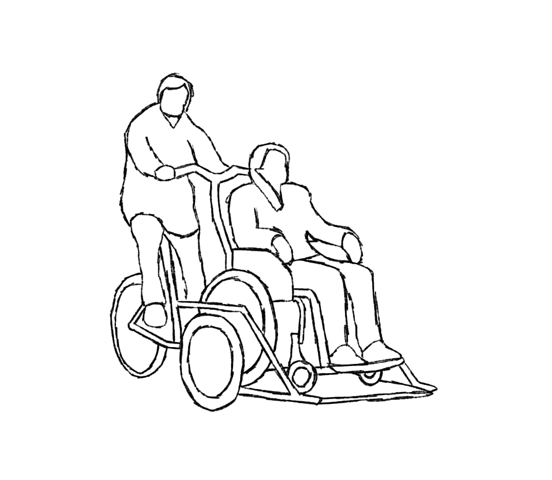
The commitment to co-design and accessibility really stood out. Bringing in access expertise from the outset, creating multiple routes for participation, and working across an inner-city school, library, the college and Sparks made the project feel genuinely inclusive.
We were struck by how clearly the project connected heritage to the future of Broadmead. Rather than treating heritage as something fixed, you used it as a way for people to articulate what matters to them now and what they want to influence going forward.
The focus on Feelings About Place was a particularly effective way of evidencing that shift in confidence, pride and belonging without overcomplicating evaluation.” Sandra Stancliffe, Head of Community Heritage, Inclusion and Learning, Historic England
You can hear Julius recalling his early years in 1930s St Pauls on the Oral History layer of Know Your Place.
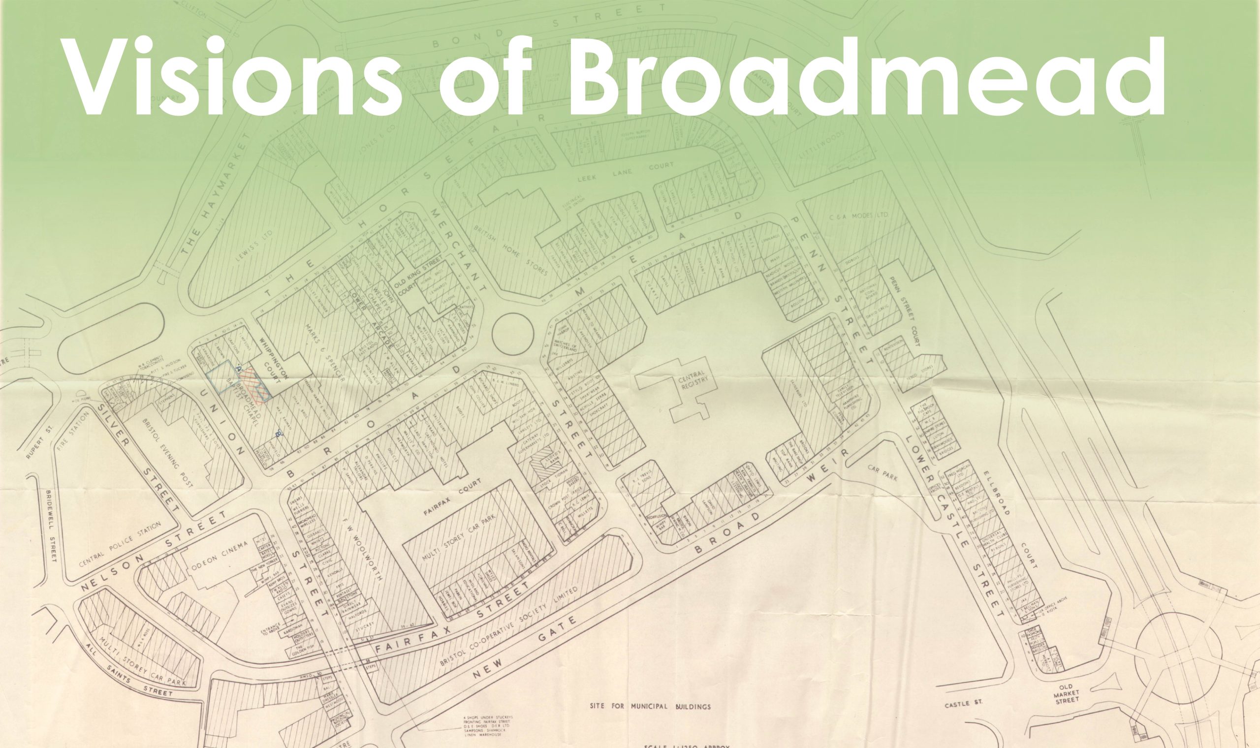
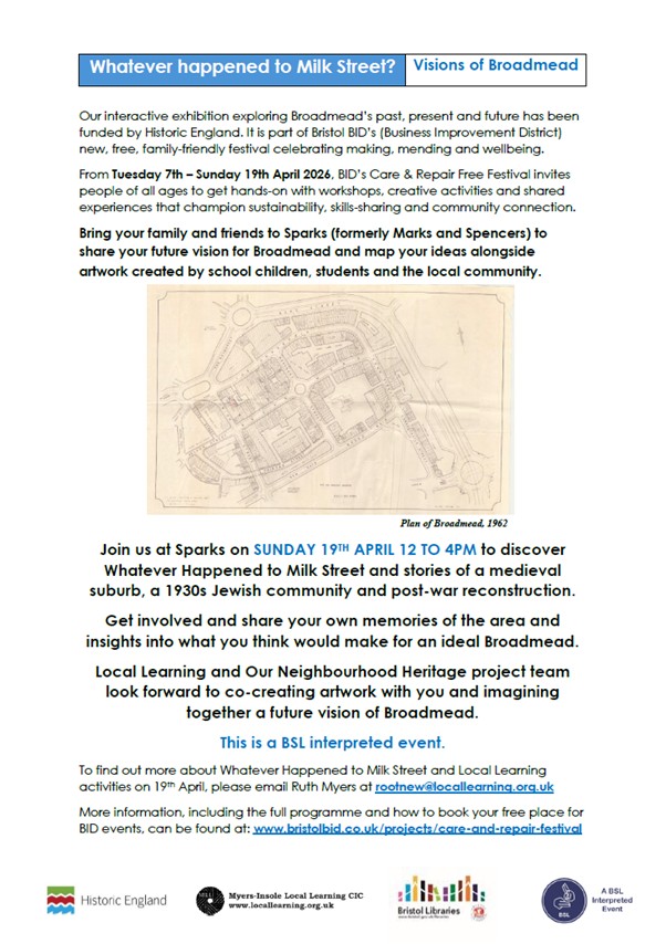
The houses, shops and streets depicted in Julius’s map were largely removed during the post war re-planning process that created the present Broadmead shopping area and associated inner ring road. This top-down approach was typical of the time, with city planners keen to forge a new future with what they felt would best serve the people of Bristol; a 1950s one-stop shopping area with a gallery of department stores intended to fulfil shoppers’ every want and need. Little thought was given to the wants and needs of the neighbourhood as their homes faced demolition and the prewar community was displaced with minimal, if any consultation.
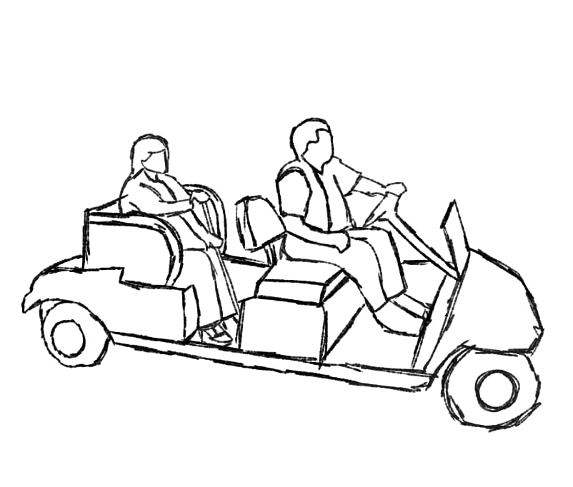
Broadmead and its road system is again undergoing a process of change. Unlike urban planning in the past, as we approach this new phase in Broadmead’s development there is an opportunity for the people of Bristol to come together to share what they think would make for a welcoming and inclusive space, accessible and inviting to all.
Students from Willow Park Primary School and City of Bristol College considered what was needed to create a perfect shared environment and produced their own designs for an ideal Broadmead.
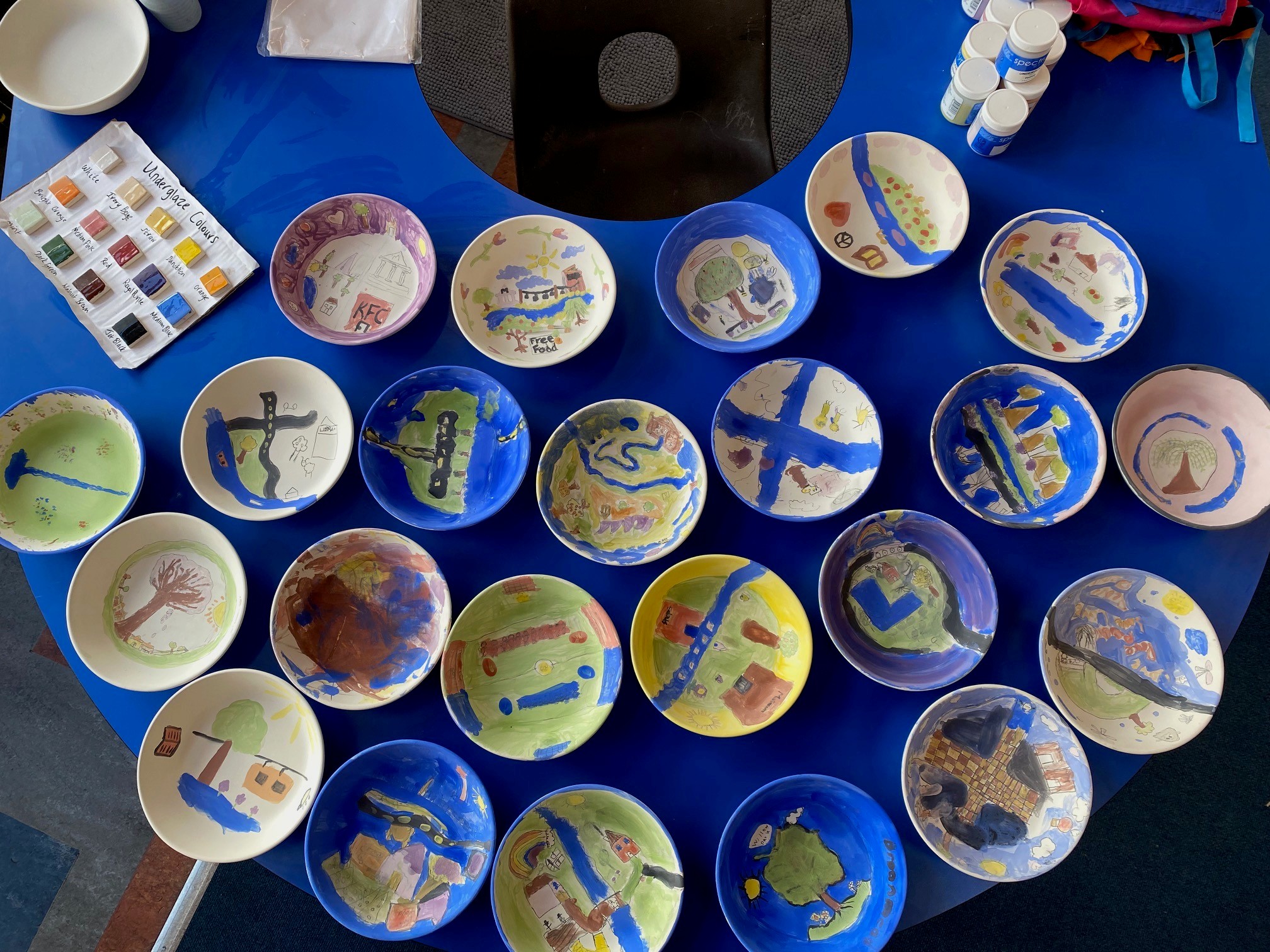
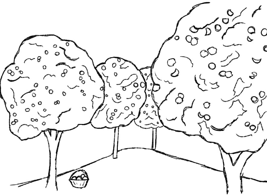
To consider an ideal future, pupils from Willow Park revisited the past following an ancient path from their school grounds. They imagined a Roman landscape, before St Michael on the Mount Without was built, when the River Frome flowed through the city, passed farmsteads and pastures and broad meadowland.
2000 years of heritage and considerations for today informed their designs, drawing on the flora and fauna from a previous time, the children placed an emphasis on the natural environment and decorated bowls with their vision of a perfect and fully accessible future Broadmead.

Acknowledgements
Our Neighbourhood Heritage project was made possible with grant funding from Historic England.
Myers-Insole Local Learning is a small, Bristol-based community interest company that aims to explore local heritage with all members of the community to uncover and share what we learn about our past. We enjoy working closely with a variety of partners in neighbourhoods across Bristol, using heritage as a vehicle to help strengthen community cohesion. We work collaboratively with other specialists to create engaging and inclusive learning experiences for all participants. In all Local Learning projects, we ensure that the people best placed to tell the story are at the heart of our projects, steering its direction from the outset and build on their specialist knowledge and experience to inform the process and shape final outcomes.
Whatever Happened to Milk Street? began with a hand drawn map hand drawn by the late Julius Burke and we would like to say a very special thank you to Julius’s family; Sonia Elliman and Steph, Vicki and Bette Burke for sharing the map and without whom there would be no story and no project. We are also particularly grateful to our friends at Bristol Libraries and Sparks and appreciate the space provided to bring people together.
Local Learning workshops and community activities were co-designed and co-delivered by Daisy Holder, Esmé Williams, Jess Baum, Pete Insole, Roxanne Butler and Ruth Myers.
British Sign Language (BSL) interpretation by Sherrie Eugene-Hart.
Local Learning would also like to thank the following people and organisations for their enthusiastic participation and kind and generous support, sharing insights and hosting activities and helping to bring people within the community together: Akeem, Ali Avery, Angela Baum, Angela Myers, Anthony, Arron, Ben Royston, Bristol Central Library, Charlie Miles, City of Bristol College, Claire Ettery, Claire Jones, Clare Sandler, Dom, Ed Campbell, Ffion, Genevieve Sissons, Hayley Ngan, Heather Anne, Helen Beales, Helen Vegoda, Jackie Aslan, Janet George, Jasmine Franck, Jenny Foster, John Henry Philips, Julien Weston, Kasey, Kevin, Laura Bird, Madeleine Samuel, Marian Liebmann, Mariola, Martin Vegoda, Mekella Broomberg, Mel Myers, Noam Adani, Poppy Krivine, Raphael Fischer, River, Dr Rose Wallis, St Pauls Library, Sam Baum, Sandra Stancliffe, Shulah Palmer-Jones, Sophie Evans, Sparks, Stav Meishar, Stephen George, Steve Roser, Sue Knights, Suki Grant, Tiffany, Vajrin Malin, Years 3 and 4 pupils at Willow Park Primary School and the wider school and college communities.